This is the log of my western vacation in September 2010. Some of my own photographs are included and some from Wikipedia.
For stage one, my father and I flew Southwest Airlines from Pittsburgh to Denver, CO, with a layover in Orlando, FL. On the way south, we could see the edge of Hurricane Earl from the jet. Going west, we passed over the Gulf of Mexico, and the presence of oil from the Deepwater Horizon spill was easily discernible in spots even at 30,000 ft. The water had the mottled appearance of a puddle in a parking lot.

My brother Danny picked us up at the Denver airport, and we stopped back at his apartment to gather his stuff. Then about 6:00PM, we hit the highway for the first stage of the drive. Dan wanted to travel west on I-70 so we could see a bit of north-eastern Utah. I drove us from his apartment, north on 470 to I-70, then west through the mountains.

What a fantastic stretch of road this is! We took it slow for the first twenty miles or so, as there was quite a bit of Labor Day Weekend traffic on the highway, but that cleared out somewhere near the Idaho Springs exit. It was full speed ahead for the climb to the Eisenhower Tunnel, and then more than full speed ahead down the other side. The Eisenhower Tunnel crosses the Continental Divide (separating the Missouri/Mississippi Rivers drainage from the Pacific Ocean drainage of the Colorado River) at over 11,000 feet elevation, which is the highest point in the U.S. Interstate system. Dan's Jeep Liberty had a few acceleration issues at 10,000 ft. and above, and a little jitter as I was standing on the brakes coming down from the pass.
I-70 is a great reintroduction to the West when you've been away for a while. We entered the interstate right near the Dakota Hogback ridge, then went up and down mountains right away. We saw one that still had snow on top- we could see that peak from the plane as well. It takes a few miles to start to see mountains with a discernible treeline, but it's not long until the highway itself is close to that treeline. On the eastern side of the divide, the highway follows Clear Creek which is occasionally visible from the highway, and then picks up the Colorado River on the west. There's one tunnel on the highway between Denver and the Divide, as well.
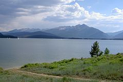
Past the Divide, we leveled out at the towns of Dillon and Frisco, which sit on the Dillon Reservoir, surrounded by Rocky Mountains. Next up was the climb to the Vail pass and the ski town of Vail, which seems busy any time of year. The highway runs right through town and past the slopes, which are to the south of the highway.
The mountains continued right up to the entrance of the Glenwood Canyon. This is one of the most spectacular parts on I-70, but we got there a bit past dusk, a little too late to fully enjoy it. Nevertheless, it's quite breathtaking. The highway hugs the northern side of the canyon, and travels through several tunnels. There are a number of places in here where the lanes are built overtop of each other, in order to minimize the construction damage to the canyon. There's railroad tracks on the other side of the river, which go through some tunnels as well.

At the bottom of the canyon is Glenwood Springs, where we spent the night. We ate at the Glenwood Brewery, and Dan reported that the beer was very good. Then we spent the night at the Glenwood Motor Lodge.
No comments:
Post a Comment