Sunday, November 28, 2010

Western Vacation 2010 Day Five: September 7

This is the log of my western vacation in September 2010. Some of my own photographs are included and some from Wikipedia.


We set off to the east from Mammoth, through Tower Junction and up into the Lamar Valley. Along the way we saw many bison and a single coyote who crossed the road very near our car.


Then we saw a traffic jam caused by many people watching a wolf feed on a carcass in the Lamar River. Several coyotes appeared and started calling (howls and barks), and before ten minutes passed at least three more coyotes appeared. They made an attempt to run the black wolf off but another gray wolf appeared on the bank and the coyotes dispersed. We went up a bit further and saw a bear-jam, but saw no sign of the animal. The ranger said it could be all day.


Somewhere during this time we stopped to see the Petrified Tree. We ate our lunch at Tower Falls, just past the Hanging Cliff. Out of Tower Junction we headed south towards Canyon Junction. This road crosses the Dunraven Pass near Dunraven Peak and Mount Washburn, the highest road in the park.


At Canyon, we first walked the trail down to the brink of the Lower Falls. From this trail we got our only glimpse of the Upper Falls.


Next we walked out to Inspiration Point. You cannot see the falls from here, but the view of the canyon is truly inspiring. The point itself is a precarious looking rock hanging out from the edge. Finally we went to Artist Point, which is the most famous spot for viewing the Lower Falls.


Next we took the trail to Cascade Lake to check out the fishing. There was no chance of catching anything there with my rod, so we all hiked the trail to Observation Peak.


The hike to the peak was about 3 miles of uphill, to around 10,000 ft. From the top we could see the Tetons, the Absarokas in the east, the Gallatins in the northwest, the Boiling Spring, and a bit of the canyon. There's much fire damage to see in the area. Round trip on this hike was about 10 miles. That would prove to be the most difficult hike we would make.


We were unable to eat at Canyon, so we drove back to Mammoth via the Norris Junction and ate at the cafeteria.


Western Vacation 2010 Day Four: September 6

This is the log of my western vacation in September 2010. Some of my own photographs are included and some from Wikipedia.


This morning we took a float trip on the Snake River with the Triangle X Ranch. They do a good job in coordinating the trip and providing the gear and a knowledgeable guide. Except for a small cloud which covered the peak of Grand Teton itself, we had perfect cool weather. This bald eagle was the only animal we saw though. We met folks from Virginia and Carlisle, PA on the raft.


Now after we ate our leftover lunch in Jackson Hole, it was time to head north to Yellowstone. It takes a long time to get around GTNP when you leave from Jackson - the lake is long. Once you get past the lake, you start to climb up to the divide which runs through southern Yellowstone.


In southern Yellowstone, we saw vast pine forests damaged by the great fires of a few years ago. There's a large gorge right next to the road on the way in (Snake River), and a waterfall coming out of Lewis Lake. The lakes in Yellowstone are very large. We also saw the first of many bison grazing in the woods and fields.


We took the Grand Loop Road to the west at West Thumb (on the big lake), and stopped at Old Faithful. We saw an eruption about 10 minutes after we arrived.


The rest of the day we drove north on the Grand Loop Road from Old Faithful to Madison Junction, then Norris Junction, then finally to Mammoth, where we stayed. Most of the thermal areas in the park are along this stretch, visible from the highway. They look like Pennsylvania strippings with steam rising from them. The Firehole River parallels the road through some of this stretch too, and many people were fishing there.


After dinner at the fast-food restaurant in Mammoth, Dad and I tried fishing in the Lower Gardner River below Mammoth, but didn't have any luck. We did see some deer there though. This let us cross the border into Montana for the first time on the trip, as well.


We stayed in a rustic one-room cabin for the rest of our time in Yellowstone. It was small, but comfortable (once we got the heater working), and the public bathrooms were right behind our unit. There's a rather sizable village in Mammoth with several restaurants, the large Hotel, a post office, and many other buildings. The elk are pretty tame, and lay around throughout the day in the public areas.


We could hear the elk through the night bugling in the hills. Quite an eerie sound. I took a walk in those hills after dark, just to stretch my legs.


Thursday, November 25, 2010

Western Vacation 2010 Day Three: September 5

This is the log of my western vacation in September 2010. Some of my own photographs are included and some from Wikipedia.


Our first stop in the morning was at the Jackson Whole Grocer. Their deli made some very good sandwiches.


We drove north out of Jackson Hole into Grand Teton National Park. This drive is perfectly designed- you cannot see the Tetons until you come around the northern edge of the Western Gros Ventre Butte. Once you do, you can see them in all their glory. This is the only place I have ever seen that brought tears to my eyes by its striking beauty.


There is a park road that parallels 191 and the Snake River, at which point you must pay the joint park access fee of $25. Along this route, we stopped and took pictures and saw a large herd of elk. We stopped at the Colter Bay on Jackson Lake.


After our lunch we did a hike from Jackson Lodge on the Lakeside Trail. It was very windy and cold- so much so that the boats stayed off the water.


Next we did our first mountain hike - up the road climbing Signal Mountain. This is a paved road, so many cars were taking passengers to the top. We saw deer, elk, and even a black bear in a tree. There are a few places here where the mountains peek through the cover too. Of course, there is a great view of the mountains from the top. We took a woods trail back down and saw another deer.


After dinner at Signal Mountain Lodge, we drove south on the park road with stops at Jenny Lake and the Lupine Meadow Trailhead. There were many more elk in this area. The Trailhead was the closest we came to the base of the Tetons.


And then just at dark we saw two bull moose feeding at the Snake River. Cross another new animal off the list!


Saturday, October 02, 2010

Western Vacation 2010 Day Two: September 4

This is the log of my western vacation in September 2010. Some of my own photographs are included and some from Wikipedia.


Before we hit the road from Glenwood, we made a stop at the Glenwood Walmart for some supplies. We did take the time to take some mountain pictures in the beautiful morning light. We saw a good bit of town, and Dad had some good stories about the area from past trips he'd taken. Then he drove us out of town to the west on I-70.


It seems like the Glenwood Canyon marks the edge of the most massive of the Rocky Mountains. The mountains west of Glenwood are more spread out, and show more features of the Great Basin Desert (like sagebrush, mostly). The road continues to follow the Colorado River (which has its headwaters, by the way, in Rocky Mountain National Park).


We turned north off the interstate in the town of Rifle (Dad liked the name). We went north on CO 13, up to Meeker. This road started out in a dry, rocky desert area with many buttes and formations, but as we approached Meeker we climbed in elevation and entered a greener cattle range. In Meeker we turned west on CO 64. We passed (and stopped at) the Rangely Reservoir, and had a pleasant chat with a local who told us about the local wildlife. This area is hilly desert country once again. Then we picked up US 40 at Dinosaur and took that west towards Utah. This road is high desert, and starts to flatten out. A large, rocky reef parallels this road to the north all the way into Utah (the edge of the Yampa Plateau), and large mountains were visible to the north west. Behind that ridge is Dinosaur National Monument. We didn't stop this time.


Our lunch stop was in Vernal, UT. For someone from Pennsylvania, Vernal doesn't quite live up to its name, but the Green River coming through town does make it much greener than the surrounding desert. Vernal is a big town, definitely the biggest we saw all day until we got to Jackson.


I took over the drive from Vernal, and we went north on US 191. We climbed immediately, passing through a large reef in the Utah badlands, then switching back as we climbed the foothills of the Uinta Mountains. As the road climbs, it passes from the Utah desert to a greener mountain forest. We stopped close to the edge of this, to view the desert from an overlook with some information about local phosphorous mining.


191 passes through the Uintas before arriving in Wyoming, and this area is high, green and rugged. We saw quite a few campers in the thick lodgepole forests, and some cattle as well.


We turned left on UT 44, to see the west side of the Flaming Gorge National Recreation Area, and were glad we did. There's many switchbacks coming down from the Uintas to the gorge, and a nice overlook along the way, from which we took this picture. Off in the far distance we could see Flattop Mountain, and many other buttes and peaks in the Wyoming desert. The Gorge itself is a large lake, full of speedboats and fishermen. Actually, you see quite a few lakes in the west full of speedboats.


Once we dropped into the Gorge and started along the river, the terrain flattened out and continued to do so as we went north. We passed a few farms near the Green River, near the town on Manila. Once we passed through there, we paralleled the river on UT 530 to the north. There's nothing but sagebrush, grass, and rocks through here. The speed limit goes up to 70 (on a two-lane road), and there's no reason why you couldn't do 90. There are buttes and formations on the west side of the road here, and the gorge/lake are off to the distance in the east. We saw our first antelope in this section, and found something on the map called the Greater Green River Intergalactic Spaceport. No sign of any spaceships though.


We stopped in Green River, where I-80 passes through, and took the interstate west several exits. The speed limit is 75 here. Then we turned north on UT 372, to US 189. This is a fun stretch of road; it's absolutely barren. The rock formations are gone here, and there is nothing but a flat, desolate plain of sagebrush. You can see the signs of mining off in the distance, and gas and oil wells throughout. We did 80 mph this whole stretch, and you hardly even notice thanks to the openness.


Once we got about to the town of La Barge though, we started to see mountains both to the west and east. There were quite a few large, snowcapped peaks to the northeast, part of the Wind River Range. The distances were probably a hundred miles to each, but that range and the Wyoming Range on the west meet in the north, between La Barge and Jackson. Once we passed the Fontenelle Reservoir, we started to notice some badlands as the ground gained elevation.


We made a few neat sightings in this section. First, a large wildfire was burning on the back of one of the mountains to the west, and the smoke was noticeable even in the valley we were passing through, thirty miles away. Further north yet, a large thunderstorm was blowing up over the Wyomings. We managed to escape with just a few raindrops, but it was fun to see the cumulonimbus and lightnings on the wide open prairie.


We hit US 191 in the town of Daniel, then crossed the headwaters of the Green River and crossed a continental divide into the Snake River basin. This was a gentle desert pass, with mountains closing to the east and west. As they did, the terrain got greener and greener. Finally we were squeezed into the Hoback River canyon as it dropped towards Jackson Hole. This is quite a tight, high canyon - very scenic.


around.


Once you pop out of the Hoback, you're in Jackson. Or at least its suburbs. Yes, Jackson has suburbs, mostly ranches surrounding Grand Teton park. The Hoback River joins the Snake south of Jackson, and although it's not part of the Hole (nor nearly as wide), the valley here is flat, wooded and lovely. You don't have to go too far north here until you're into two lane highway, with businesses all

The best part of coming in this way though, is that the Teton Range is entirely hidden the hole time, due to East Gros Ventre butte just to the west of town. In downtown Jackson, we could see the top of Grand Teton itself for just a minute, but we never saw the range at all this day. And instead of going to look, we found our hotel (the El Rancho), ate at the Silver Dollar steakhouse, and called it a night. Quite a day of driving!


Western Vacation 2010 Day One: September 3

This is the log of my western vacation in September 2010. Some of my own photographs are included and some from Wikipedia.


For stage one, my father and I flew Southwest Airlines from Pittsburgh to Denver, CO, with a layover in Orlando, FL. On the way south, we could see the edge of Hurricane Earl from the jet. Going west, we passed over the Gulf of Mexico, and the presence of oil from the Deepwater Horizon spill was easily discernible in spots even at 30,000 ft. The water had the mottled appearance of a puddle in a parking lot.


My brother Danny picked us up at the Denver airport, and we stopped back at his apartment to gather his stuff. Then about 6:00PM, we hit the highway for the first stage of the drive. Dan wanted to travel west on I-70 so we could see a bit of north-eastern Utah. I drove us from his apartment, north on 470 to I-70, then west through the mountains.


What a fantastic stretch of road this is! We took it slow for the first twenty miles or so, as there was quite a bit of Labor Day Weekend traffic on the highway, but that cleared out somewhere near the Idaho Springs exit. It was full speed ahead for the climb to the Eisenhower Tunnel, and then more than full speed ahead down the other side. The Eisenhower Tunnel crosses the Continental Divide (separating the Missouri/Mississippi Rivers drainage from the Pacific Ocean drainage of the Colorado River) at over 11,000 feet elevation, which is the highest point in the U.S. Interstate system. Dan's Jeep Liberty had a few acceleration issues at 10,000 ft. and above, and a little jitter as I was standing on the brakes coming down from the pass.


I-70 is a great reintroduction to the West when you've been away for a while. We entered the interstate right near the Dakota Hogback ridge, then went up and down mountains right away. We saw one that still had snow on top- we could see that peak from the plane as well. It takes a few miles to start to see mountains with a discernible treeline, but it's not long until the highway itself is close to that treeline. On the eastern side of the divide, the highway follows Clear Creek which is occasionally visible from the highway, and then picks up the Colorado River on the west. There's one tunnel on the highway between Denver and the Divide, as well.


Past the Divide, we leveled out at the towns of Dillon and Frisco, which sit on the Dillon Reservoir, surrounded by Rocky Mountains. Next up was the climb to the Vail pass and the ski town of Vail, which seems busy any time of year. The highway runs right through town and past the slopes, which are to the south of the highway.


The mountains continued right up to the entrance of the Glenwood Canyon. This is one of the most spectacular parts on I-70, but we got there a bit past dusk, a little too late to fully enjoy it. Nevertheless, it's quite breathtaking. The highway hugs the northern side of the canyon, and travels through several tunnels. There are a number of places in here where the lanes are built overtop of each other, in order to minimize the construction damage to the canyon. There's railroad tracks on the other side of the river, which go through some tunnels as well.


At the bottom of the canyon is Glenwood Springs, where we spent the night. We ate at the Glenwood Brewery, and Dan reported that the beer was very good. Then we spent the night at the Glenwood Motor Lodge.


Sunday, July 18, 2010

Give Unto the LORD

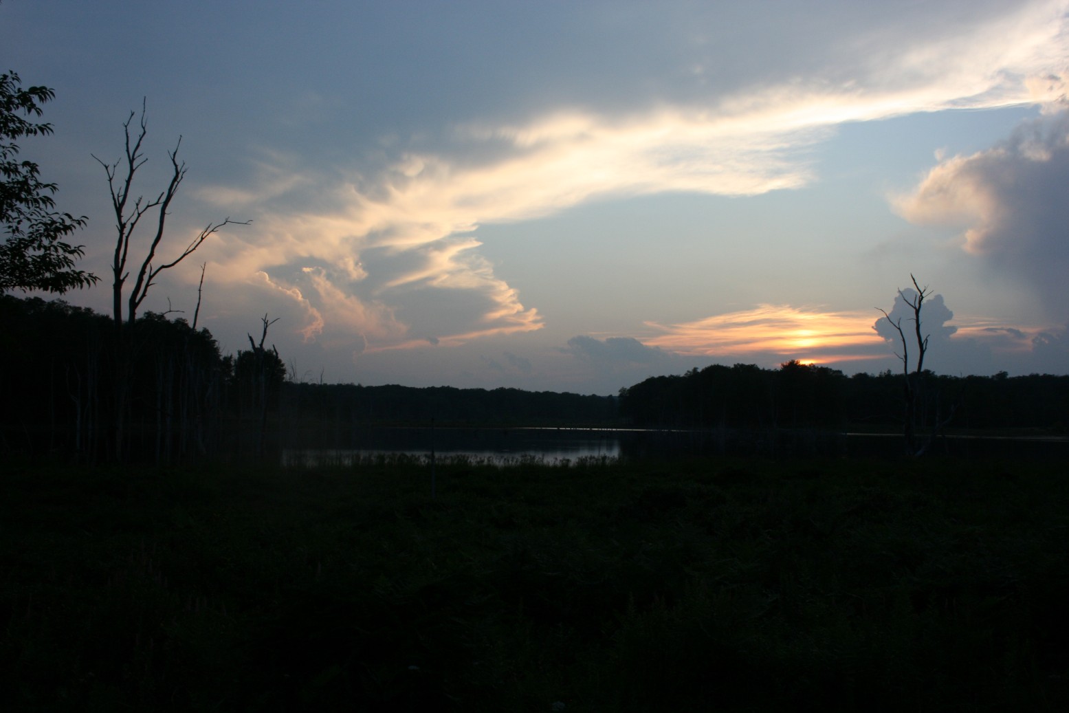
Last night Curwensville experienced the most violent electrical storm I can remember in my life. From out in the Quehanna Wild Area, I took these photos of the thunderhead as it approached.


Give unto the LORD O ye mighty,

Give unto the LORD glory and strength.

Give unto the LORD the glory due unto His name;

Worship the LORD in the beauty of holiness.


The voice of the LORD is upon many waters;

The God of glory thundereth;

The LORD is upon many waters.

The voice of the LORD is powerful;

The voice of the LORD is full of majesty.

The voice of the LORD breaketh the cedars of Lebanon;

Yea, the LORD breaketh the cedars of Lebanon.

He maketh them also to skip like a calf;

Lebanon and Sirion like a young unicorn.

The voice of the LORD divideth the flames of fire;

The voice of the LORD shaketh the wilderness;

The LORD shaketh the wilderness of Kadesh.

The voice of the LORD maketh the hinds to calve,

And discovereth the forests,

And in His temple doth everyone speak of His glory.

The LORD sitteth upon the flood;

The LORD sitteth king forever.


The LORD will give strength unto His people;

The LORD will bless His people with peace.


Psalm 29

Sunday, October 11, 2009

Living it Out

For our appeal does not spring from error or impurity or any attempt to deceive, but just as we have been approved by God to be entrusted with the gospel, so we speak, not to please man, but to please God who tests our hearts. For we never came with words of flattery, as you know, nor with a pretext for greed— God is witness. Nor did we seek glory from people, whether from you or from others, though we could have made demands as apostles of Christ. - I Thess. 2:3-6


Many times, I have heard Christians talk about the need to "live the Gospel", as opposed to just preaching it. Sometimes I think that's a hollow cliche, but I think this passage shows us what it means to "live the Gospel", or "preach the Gospel without actions".


The summary: make sure your ministry is free from a desire for glory and riches. Make the approval of God your prize, not the approval of man or their money. That's how to preach the Gospel with your life.